Where to burn – When to burn – What to burn
Get in touchAbout the company
JLR Consulting is a Windhoek based environmental company run by Johan le Roux - MSc Applied Remote Sensing, PhD Environmental Science.
The company provides specialised information that allows a targeted approach to fire management in savanna landscapes. Where to burn; when to burn; what to burn.
Contact us
 Dr Johan le Roux
Specialising in
- Bushfire information, including geospatial analysis of the long-term fire history for your area of interest, as well as monitoring of the current fire season in near real-time.
- Bushfire management planning, implementation and monitoring.
- QGIS training - customised to fit your requirements.
- QGIS manual (customised “cookbook”) development.
News updates
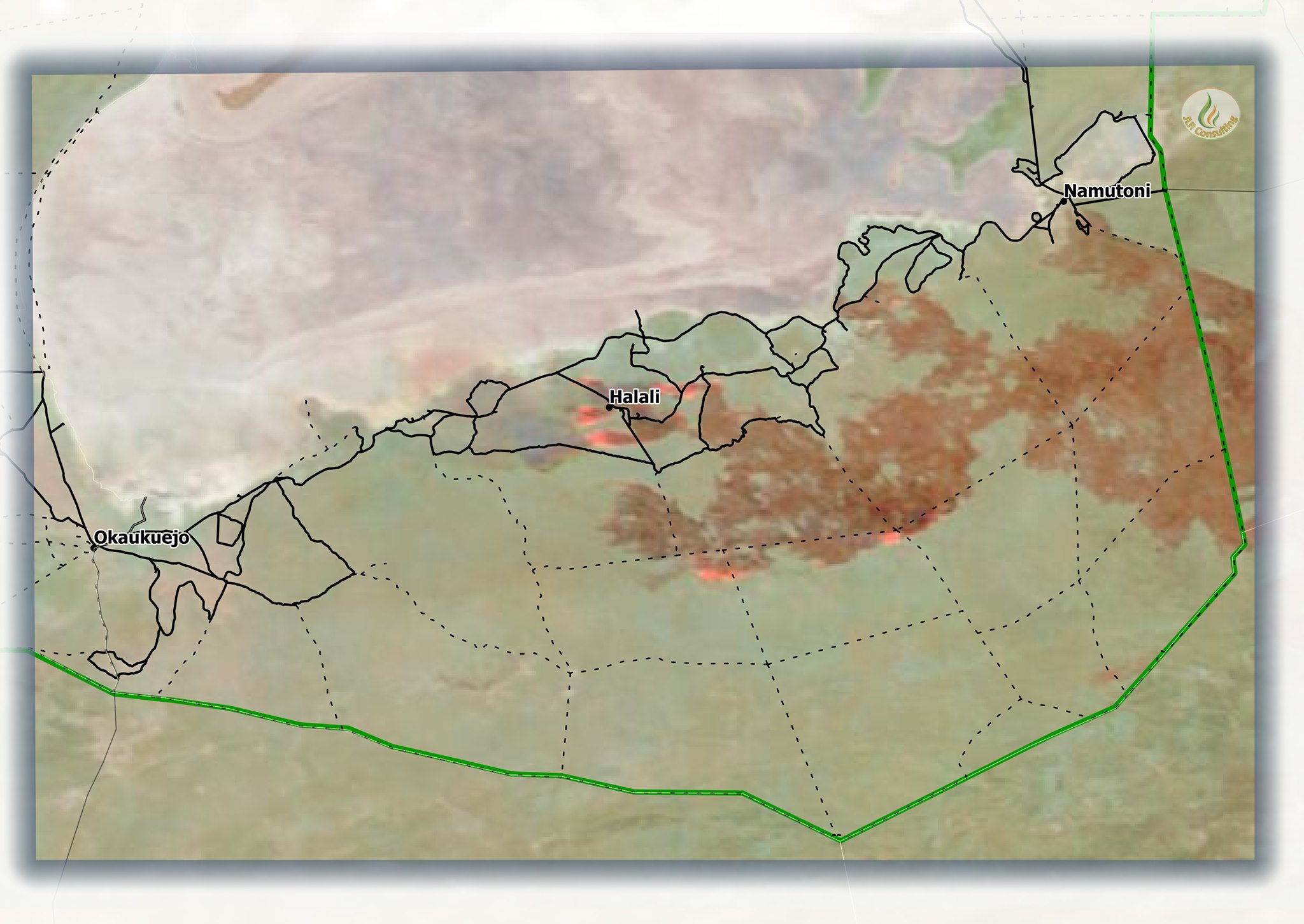
This colour composite image shows the direction and extent of the fire in the Halali area of Etosha National Park on 17 October. Solid black lines indicate tourist road. Dotted black lines are fire breaks or ENP staff patrol roads that are NOT accessible to the public. (Mapped by JLR Consulting from NASA/FIRMS MODIS data) 17 October 2020 12h00